


Brisbane summers make a strong case for cold water. The good news is you don't have to drive far to find it. There's a reservoir with a marked swimming area 25 minutes from the CBD, and a rainforest creek at Samford not much further.
This guide covers seven swimming holes you can get to and back from in a day. Two are close enough for an after work dip. Three are up in the Sunshine Coast hinterland and the Gold Coast valleys. One needs a 4WD, and one needs a proper hike.
None of them has a lifeguard, and all of them change after rain. There's a section on that near the end, and it's worth reading before you go.
Quick answer: the best swimming holes near Brisbane
| Swimming hole | Area | Drive from the CBD | Walk in (return) | Good to know |
|---|---|---|---|---|
| Cedar Creek | Samford | About 40 min | 1 km | Busy on summer weekends |
| Enoggera Reservoir | The Gap | About 25 min | Short | Marked swimming area, café |
| Rocky Hole | Mount Mee | About 1 h 30 min | 0.4 km | 4WD recommended |
| Gardners Falls | Maleny | About 1 h 15 min | 0.6 km | Council doesn't encourage swimming |
| Kondalilla rock pool | Montville | About 1 h 30 min | 2.4 km | 300+ steps |
| Currumbin Rock Pools | Currumbin Valley | About 1 h 15 min | Short | Picnic tables and toilets |
| Lower Portals | Mount Barney | About 1 h 45 min | 7.4 km | A proper hike to a gorge pool |
Drive times are our estimates without traffic.
Short on time? Enoggera. Want the classic Brisbane creek swim? Cedar Creek. Want a day out? Lower Portals.
1Cedar CreekSamford
The spotA run of rock pools, cascades and small waterfalls in the bush under Mount Glorious, about 40 minutes from the city.

This is the one most Brisbane locals mean when they say "the creek". Head out of Samford on Mount Samson Road and turn onto Cedar Creek Road, which follows the water up the valley.
Queensland's tourism board puts the easy access at Andy Williams Park, where you can swim close to the car. Walk upstream along the creek and the pools get bigger and quieter, with small falls tumbling between granite boulders. It's about a kilometre return to the better holes and around half an hour, with some rock hopping.
The parking near the top of the road is limited and fills early on hot weekends. Some of the creek runs past private land, so stick to the public areas and don't block driveways.
Don't mix it up with Cedar Creek Falls on Tamborine Mountain. That's a different spot, an hour south, covered at the end of this guide.
Where Cedar Creek Road, Samford Valley, about 40 min north west of the CBD
Difficulty Moderate
Distance 1.0 km return
Duration 30m
ParkingNo toilets2WD accessTelstra 4GNo dogs
Best time December to February, early on a weekday
Entry Free
Official info Queensland tourism, swimming holes near Brisbane
Exact location In the Sole Drift app
Heads up: Cedar Creek rises fast after storms in the ranges. Stay out of the water during or just after heavy rain, and never jump from the rocks. Depths change and logs move.
2Enoggera ReservoirThe Gap
The spotA bush-lined reservoir in D'Aguilar National Park with a marked swimming area, 25 minutes from the CBD.

This is the easiest swim on the list, and the closest. You get in through the Walkabout Creek Discovery Centre off Mount Nebo Road, park, and walk down to the water.
Swimming is only allowed inside the area marked by large yellow buoys, and Seqwater is clear that swimming anywhere else is not permitted. It isn't patrolled.
Seqwater opens the reservoir every day, from 5:30 am to 6:30 pm between September and April and 6 am to 5:30 pm from May to August. The discovery centre has a café, toilets and parking, and on weekends, public holidays and school holidays you can hire kayaks and paddleboards.
Where Walkabout Creek, Mount Nebo Road, The Gap, about 25 min from the CBD
Difficulty Easy
Distance 0.6 km return
Duration 15m
ParkingToilets2WD access
Best time A hot weekday morning, before the families arrive
Entry Free. Swim only inside the yellow buoys
Official info Seqwater, swimming at Enoggera Reservoir
Top tip: Seqwater closes the reservoir to swimming after big inflows and posts alerts on its website. Check before you drive out, especially after a wet week.
3Rocky HoleMount Mee
The spotA deep pool cut into the granite of Neurum Creek, deep in the Mount Mee forest.

Rocky Hole is the reward for a slow drive. It's in the Mount Mee section of D'Aguilar National Park, and Queensland Parks recommends a 4WD or trail bike to get there along the forest roads, where the limit is 40 km/h.
From the Rocky Hole car park it's a short walk, about 200 metres down a lot of steps, to the creek and its string of rock pools. The main hole is deep and cold.
Plan the route before you lose signal. Queensland Parks says you can't get in via Settlement, Fyffe, Centipede or Nine V roads, and the Mount Mee access roads close after more than 100 mm of rain in 24 hours.
Where Mount Mee section, D'Aguilar National Park, about 1 h 30 min north of the CBD
Difficulty Easy
Distance 0.4 km return
Duration 20m
ParkingToilets4WD onlyNo signalNo dogs
Best time December to February, on a dry week
Entry Free
Official info Queensland Parks, Rocky Hole
Exact location In the Sole Drift app
Heads up: there's no phone signal out here. Tell someone where you're going, and download the area in Google Maps before you leave the highway.
4Gardners FallsMaleny
The spotA wide waterfall and a string of pools on Obi Obi Creek, a short walk from the road just outside Maleny.
Gardners Falls is one of the busiest swims in the Sunshine Coast hinterland, and it's easy to see why. A 600 metre return walk gets you from the car park to the falls, with shallow pools for kids and bigger, deeper ones downstream.
It also has a hard history. Sunshine Coast Council says there have been fatalities and injuries here, and it doesn't actively encourage swimming at the falls. Its safety signs ask visitors to supervise children, think about their swimming ability and watch for submerged objects.
So treat it like any natural creek: check the depth, never jump in, and stay out after rain.
Where Obi Obi Creek, Maleny, about 1 h 15 min north of the CBD
Difficulty Easy
Distance 0.6 km return
Duration 20m
ParkingToilets2WD accessTelstra 4GNo dogs
Best time January to April, when the creek is flowing
Entry Free
Official info Sunshine Coast Council, Gardners Falls
Exact location In the Sole Drift app
Heads up: the rocks around the falls are slippery and there are logs and rocks under the surface. People have died here. Swim only where you can see the bottom, and never jump or dive.
Sole Drift app
Get the app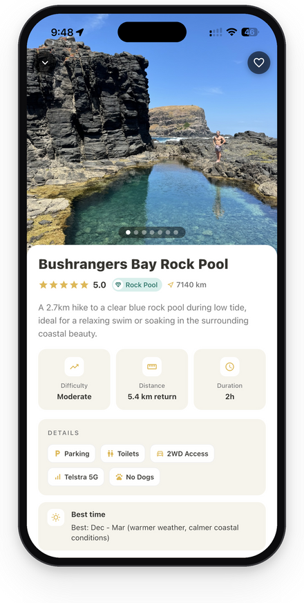
Find swimming holes within a drive of Brisbane, with the walk, parking and warnings for each. Sole Drift has 1,100+ spots across Australia.
5Kondalilla rock poolMontville
The spotA rock pool fed by a small waterfall, sitting right at the top of Kondalilla Falls.

This is the swim with the view. The rock pool sits just above where the creek drops off the escarpment, so you can swim, then carry on down the track for the view of the full falls.
The rock pools walk is 2.4 km return and takes about an hour, but Sunshine Coast Council counts over 300 steps down to the falls, so your legs will know about it on the way back. If you want more, the official Kondalilla Falls circuit continues down to the base and back up: 4.7 km return, 2 to 3 hours.
Where Kondalilla National Park, Montville, about 1 h 30 min north of the CBD
Difficulty Moderate
Distance 2.4 km return
Duration 1h
ParkingToilets2WD accessTelstra 5GNo dogs
Best time March to May, after the wet season while the falls are full
Entry Free
Official info Queensland Parks, Sunshine Coast hinterland walks
Exact location In the Sole Drift app
Heads up: Queensland Parks says never dive into creeks or rock pools here, because they hide submerged rocks and logs. Leave the sunscreen and repellent on the bank where you can, too. It harms the creek life.
6Currumbin Rock PoolsCurrumbin Valley
The spotA series of granite pools on Currumbin Creek, with grassy picnic spots right next to the road.

Currumbin is the family pick. The City of Gold Coast runs it as a park, with shelter, picnic tables, barbecues and toilets, and it's 10 to 15 minutes inland from Currumbin Beach. You can do the beach and the creek in the same day.
The pools run along the creek beside Currumbin Creek Road, from shallow edges where little kids can splash to deeper holes in the middle. There's a café across the road.
It's one of the few spots here that allows dogs, on a lead.
Where Currumbin Creek Road, Currumbin Valley, about 1 h 15 min south of the CBD
Difficulty Easy
Distance 0.2 km return
Duration 5m
ParkingToilets2WD accessTelstra 5GDogs allowed
Best time A weekday in summer, or a warm autumn day when the crowds thin out
Entry Free
Official info City of Gold Coast, Currumbin Rock Pools
Exact location In the Sole Drift app
Heads up: the rocks are slippery and the pools drop off suddenly. Check how deep a hole is before you get in, and don't jump off the rock walls.
7Lower PortalsMount Barney National Park
The spotA deep pool where Mount Barney Creek squeezes through a granite gorge, at the end of a 3.7 km walk.

This is the one to earn. Queensland Parks rates the Lower Portals track Grade 4: 7.4 km return, about 3 hours, with moderate to steep slopes, rough sections and two rocky creek crossings.
At the end, the creek pushes through a narrow gap between granite walls into a deep, cold pool. It's quieter than anything else on this list, because most people don't want the walk.
If one day isn't enough, there's a remote bush camp near the portals, booked through Queensland Parks.
Where Mount Barney National Park, near Rathdowney, about 1 h 45 min south west of the CBD
Difficulty Moderate
Distance 7.4 km return
Duration 3h
ParkingToilets2WD accessTelstra 4GNo dogs
Best time May to August for the walk, or an early start on a summer day
Entry Free
Official info Queensland Parks, Mount Barney things to do
Exact location In the Sole Drift app
Heads up: the creek crossings can become impassable after rain, and the water rises quickly. If the creek's running high at the first crossing, turn around.
What about Cedar Creek Falls on Tamborine Mountain?
It's the other Cedar Creek, and the two get mixed up all the time. Cedar Creek Falls is in Tamborine National Park, an hour south of Brisbane, and it's a lovely spot when it's open. As of October 2026, it often isn't.
Queensland Parks closed the day use area and the track to the lookout after damage from Tropical Cyclone Alfred, until it's declared safe. Closures like this are usually lifted once repairs are done, so check the alert before you write it off. The rock pools also close whenever heavy rain makes the water run high, and some pools in the gorge are off limits at all times, with fines. When it is open, the rock pools walk is 1.1 km return with a lot of steps, parking is limited, and the section is closed at night.Our call: check the park alerts before you go, and if it's shut, head to Cedar Creek at Samford instead.
Are swimming holes near Brisbane safe?
They can be, if you treat them as wild water. None of the spots here has a lifeguard. The biggest risks are hidden rocks and logs, slippery granite, and creeks that rise quickly after storms in the ranges.
Check the depth before you get in, never jump or dive, and keep a close eye on kids. Queensland Parks gives the same advice for every creek and rock pool in its parks.
Can you swim after heavy rain?
Not straight away. Rain upstream can turn a calm creek into fast, brown water within an hour, and runoff can carry bacteria. Wait until the water has dropped and cleared.
Also check whether your swim is even open. Queensland Parks closes tracks and roads after big rain (Mount Mee closes after 100 mm in a day), and Seqwater closes Enoggera Reservoir after big inflows.
Practical tips for swimming holes near Brisbane
- Check the alerts the morning you go. The Queensland Parks alerts list covers closures for every national park in this guide.
- Go early on summer weekends. Cedar Creek, Gardners Falls and Currumbin all fill up by mid morning, and parking is the first thing to run out.
- Wear grippy shoes. Wet granite is slippery, and most of these swims involve some rock hopping.
- Save the route offline. Signal drops out at Rocky Hole and patchy elsewhere. Open the spot in Maps from the Sole Drift app, then download the area for offline use. Our stay safe outdoors guide covers what else to pack.
- Going further? The Gold Coast hinterland and Sunshine Coast both have more swims within two hours, and if the dog is coming, see our dog friendly swimming holes.
- Heading south too? Our guide to Queensland spots has more, and if you're in Sydney, here are the best rock pools in Sydney.
For trips further out, see hidden gems in Queensland.
Pick a creek and go
The best swims near Brisbane aren't at the beach. They're up in the ranges, an hour from the city, where the water's cold and the shade is real.
Pick the one that suits your day, check the alerts that morning, and give the creeks a few days to settle after a storm.
Take your rubbish home, keep sunscreen out of the water where you can, and leave the rocks and plants where they are. Read our Leave No Trace guide before you go. These places stay special because people look after them.